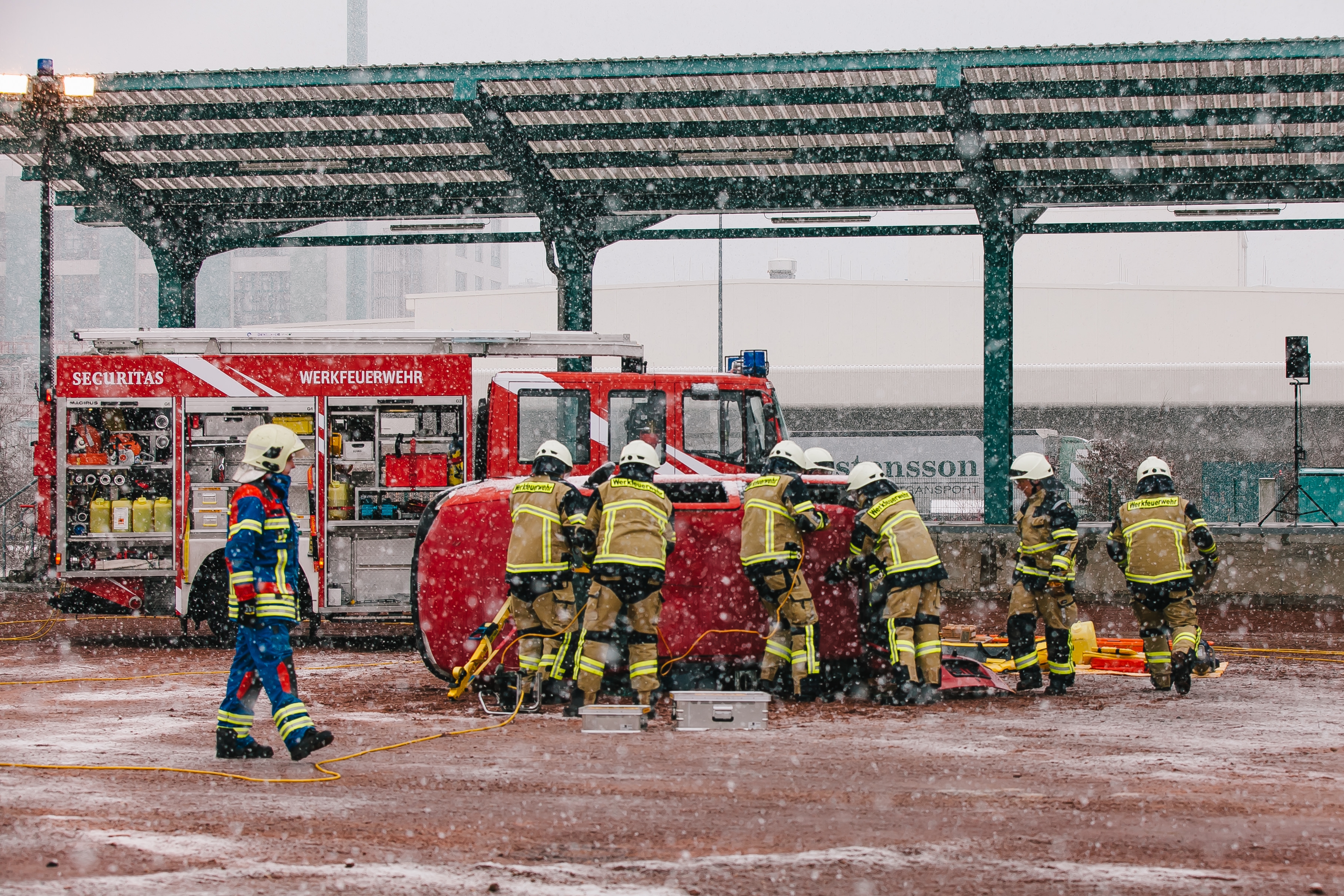
The spectrum of fire department mission scenarios is as wide-ranging as it is demanding. The fire department at a chemical plant, for example, has to deal with everything from traffic accidents and fires in or adjacent to hazardous materials storage areas to extinguishing fires in production facilities. Short travel distances in the confined and highly complex infrastructure leave firefighters precious little time for preparation. They are happy if they have enough time to put on their protective gear because once they are on the scene every second counts. Every move has to come off without a hitch.
Digital situation and decision support for fire department command centers
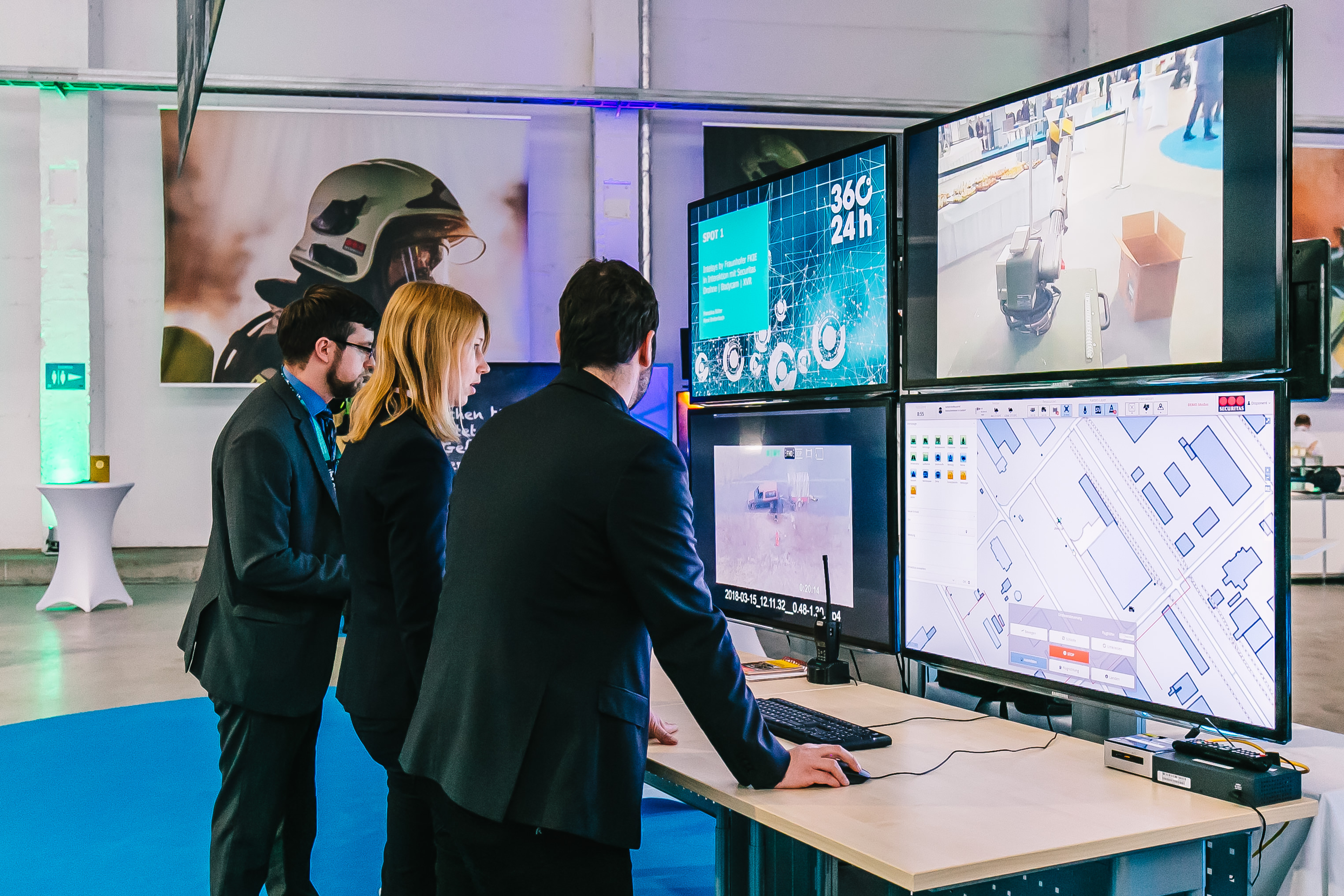
Networked command and control center
Task
Data distributed across different systems, sparse information about the situation on the ground, and a limited scope for intervention – these are often the conditions that fire departments face today. In the time-critical mission planning process, steps such as looking up hard copies of detailed information on a triggered fire alarm system, researching information on hazardous substances in a database, and ensuring that every step of the mission is fully documented from the moment the alarm is received are still part of routine operations. These are just a few examples of where end-to-end digital support would save valuable time, freeing up emergency responders to concentrate on their core tasks.
This is why fire departments of the future should have digital support and be fed information on demand without media gaps. Fraunhofer FKIE has developed a solution for this that takes a comprehensive approach. It focuses on three goals:
1. Integration into existing system environments
2. Targeted process support
3. Intelligent networking of the command center and mobile task forces.
Methodology / Approach
The comprehensive, integrated FKIE solution for digital networking and decision support for command and control centers combines a range of key technologies:
1. Integration of information from different data sources
Examples include weather data, infrastructure information, resource availability, messages and mission information from existing mission control systems.
2. Georeferenced location map
For interactive queries of infrastructure information and real-time position display of emergency personnel, vehicles and hazardous materials, for example.
3. Flexible integration of autonomous systems (UAV/UGV)
For reconnaissance and remote manipulation, so that video images and other sensor data can be made available well in advance by unmanned aerial vehicles (UAV), drones, or by unmanned ground vehicles (UGV), robots, and/or work can be carried out in hazardous areas from a safe distance.
All processes and activities of the command and control center related to the operation, starting with operational planning and dispatching, through to operations support and the subsequent generation of mission reports, are supported. The integration of relevant information from a disparate set of data sources into a single, comprehensive situation picture takes the pressure off the command center during the time-critical mission preparation phase and enhances situational awareness so that leaders can make well-founded decisions. Information relevant to operations, such as current road construction sites and closures, is automatically tracked and visually presented by the application.
Results / Outlook
The modular solution developed by Fraunhofer FKIE integrates existing systems familiar to users rather than replacing them. This facilitates user acceptance, rollout and customized support of the system depending on its intended use. Importing mission information from existing mission control systems and displaying it on the situation map enhances dispatchers' understanding of the mission context and optimizes the response time window for providing necessary resources.
The standardized database also provides better and more targeted information to the personnel on the scene, since the georeferenced situation map accessible from mobile devices enables interactive queries of mission-critical infrastructure information, such as water supply points, hazardous material storage facilities or pipe bridges.
Use Case
Pilot operation with UAV connection at Chemiepark Bitterfeld-Wolfen
In addition to its testing in military environments and in civilian airport operations, the FKIE command and control system has been adapted as a pilot system for the plant fire department of the Bitterfeld-Wolfen Chemical Park. It is being provided by the company Securitas. To implement the map-based situation display, infrastructure data for the chemical park with information on buildings, pipe bridges, hydrants, roads and rails was integrated into the system and processed. This forms the basis for the display of access routes, vehicle positions, measured values from gas sensors and other spatially related information.
The mission-related situation display enables the assignment of resources and mission logging. For the dispatcher in the control center, interaction with the system will be kept as simple as possible, since he or she has to manage numerous tasks in parallel.
Using a generic command solution, the FKIE system also allows the integration of drones (UAV), robots (UGV) and other systems from a wide range of manufacturers. In Bitterfeld-Wolfen, Securitas employs body cams for the emergency personnel as well as additional UAV support from the multicopter "Fire & Safety Drone FD-8" for aerial reconnaissance. Using HD and thermal imaging cameras as well as multi-gas sensors, information is collected from a bird's eye view and made available to the emergency responders.
The dispatcher controls the flight and camera orientation of the drone directly from the system with commands such as "Move" or "Circle". With the "Circle" command, for example, the dispatcher can specify a target point with a single click. The UAV automatically flies to this point, circles it in a predefined radius and keeps the camera pointed at the center of the flight radius, the predefined target point.
Without additional work, the dispatcher receives a live feed of the situation on site from different perspectives, giving the command center timely information about the situation on the ground for the briefing of the incoming firefighters and, if necessary, to issue a supplementary alert. As soon as the firefighters arrive on the scene, the body cams worn during the operation supplement the live view with images of what is happening on the ground.
The FKIE demonstrator solution has now been installed in the command center of the plant fire department and is currently being tested there. In the future, it will be progressively enhanced with modular extensions and expanded by linking additional data sources and systems. UAV use will be an important component of this. If the system proves successful at the Bitterfeld-Wolfen Chemical Park, it could become a model for other sites.

